Backgrounder: Basic facts & figures about epicenter of 6.8-magnitude quake in Xizang


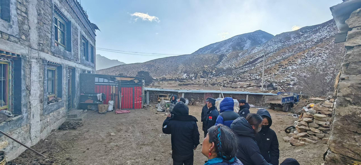
LHASA -- A 6.8-magnitude earthquake struck Dingri county in Shigatse, Southwest China's Xizang autonomous region, at 9:05 am Tuesday, with a depth of 10 km.
The epicenter was located in Tsogo township, with approximately 6,900 people living within a 20-km radius. This area includes about 27 villages.
Dingri county lies on the northern slope of the Himalayas, bordering Nepal to the south. With an average altitude of 4,500 meters, it is located near the northern base camp of Mount Qomolangma, the world's highest peak.
Nearly 90 percent of the county's land is part of the Qomolangma National Nature Reserve, which draws global attention due to its unique ecological environment.
Dingri is home to the Qomolangma Atmospheric and Environmental Research Station, operated by the Chinese Academy of Sciences. Following the earthquake, the station's facilities are reported to be in good condition.
The county seat is located 243 km from the city of Shigatse. Spanning about 13,860 square km, Dingri county has 13 townships and 180 administrative villages, with a 181-km-long borderline.
With a population of over 60,000, the county is one of the most populous border counties in Xizang.
Dingri county has a plateau temperate semi-arid monsoon climate with an annual average temperature ranging from 2.8 to 3.9 degrees Celsius.
The weather forecast showed that the temperature at Dingri went from minus 18 degrees Celsius to zero on Tuesday.


- China launches emergency response after quake strikes SW China's Sichuan
- Last 15 hikers rescued from Qomolangma snowstorm
- The guardians
- Domestic tourism sees a boom during holiday period
- Xi to deliver keynote speech at opening ceremony of the Global Leaders' Meeting on Women
- Jilin farmers harvest golden rice in autumn fields