River basins may see major flooding


Some rivers in North China's Haihe River Basin and Northeast China's Songliao Basin may experience major flooding, a representative from China's top emergency response authority said on Tuesday.
Shen Zhanli, a spokeswoman for the Ministry of Emergency Management, said at a news conference in Beijing that all seven major river basins in China have entered their main flood season this month.
"In recent years, due to global climate change, disastrous weather has become increasingly sudden, extreme and unpredictable," Shen said. "Especially during the flood season, disasters that break historical records and traditional understandings occur frequently."
She emphasized that the country is now in a critical period for flood prevention — from the second half of July through the first half of August — calling it the most complex and severe stretch for flood control throughout the year.
The peak of summer travel and outdoor construction further raises safety risks, she said.
Shen also shared the ministry's disaster risk forecast for August, warning of high risks of flooding and hail in parts of North, Northeast, East, South and Southwest China.
Two to three typhoons are expected to make landfall or affect China this month, with at least one expected to impact areas north of the Yangtze River, she said.
There is also a high risk of forest fires in the Greater Hinggan Mountains and in several parts of the Xinjiang Uygur autonomous region.
Geological disasters could occur in western areas of Yunnan province, while high-temperature drought risks loom over parts of the middle and lower Yangtze River region, the Jianghuai area — including parts of Jiangsu, Anhui and Henan provinces — and central and northern Xinjiang.
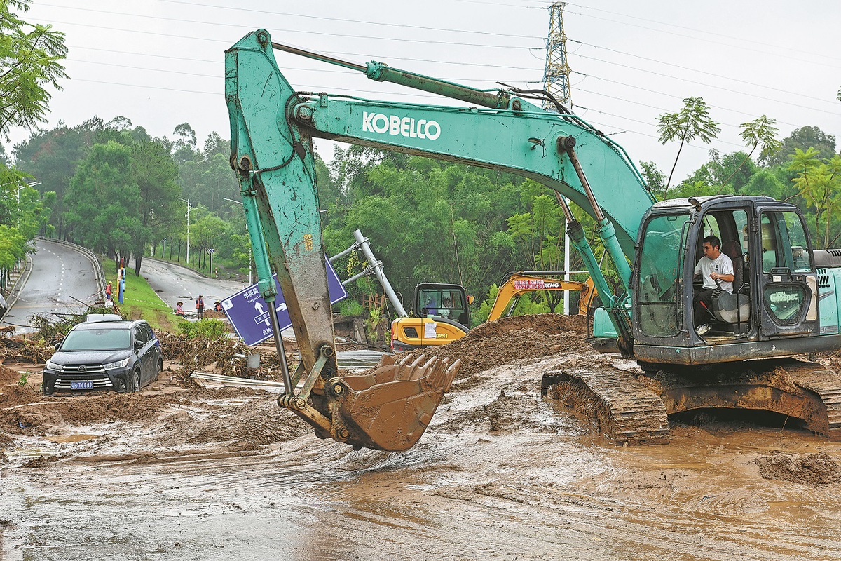
On Monday night, the State Flood Control and Drought Relief Headquarters raised its flood emergency response level from Level IV to Level III — the third-highest in China's four-tier emergency system — for Beijing, Tianjin, and the provinces of Hebei and Guangdong.
Meteorological forecasts had predicted heavy to torrential rainfall in parts of those regions from Monday evening through Tuesday.
In Guangdong, the provincial hydrology department issued six red alerts for flooding and three red alerts for mountain torrents on Tuesday — the highest warning level in China's color-coded alert system.
By Tuesday evening, emergency management authorities in Beijing and Hebei had either lowered or maintained their current emergency levels as rainfall lessened or stopped. In Tianjin and its upstream areas, heavy rainfall had also largely subsided.


- River basins may see major flooding
- Polluted data poses risk to AI safety, ministry says
- World Games to see unique opening
- Novelist captures shared culture of China's old alleyway communities
- Private war memorial hall in Shanxi draws 3.4 million visitors in 11 years
- Aid program advances Xizang's development